


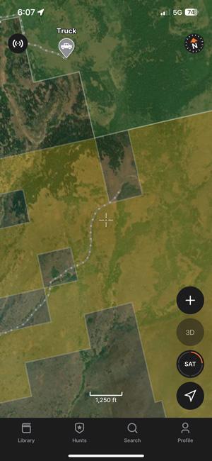
One of the most amazing aspects of hunting out West is the availability of public land. Each year, I’m excited to hike around and search out the public land hunting spots I’ve spent all off-season e-scouting on GOHUNT Maps for mule deer. When trying to find a place to hunt in a vast unit, there’s more to it than just looking aimlessly at maps. Below are several different ways to unlock the power of public land hunting by using public land layers to your advantage.
I’ve said it before, but I stand behind this statement: you’ll have a better hunt if you’re well prepared, and that starts with maps. This is why I lean heavily on planning for a hunt by using e-scouting methods before I head out to the field to scout/hunt.
One of those key ways I research is by checking out what each portion of public land looks like in a unit. For example, a unit might have a lot of public land, but don’t just assume that all public land holds animals. When I’m researching a unit, I will jump to GOHUNT Maps on the web and turn on the public lands layer (government land), and then I will take note of where that public land is and… almost most importantly, what that terrain looks like on the public land. Then I start to mark areas that look promising.
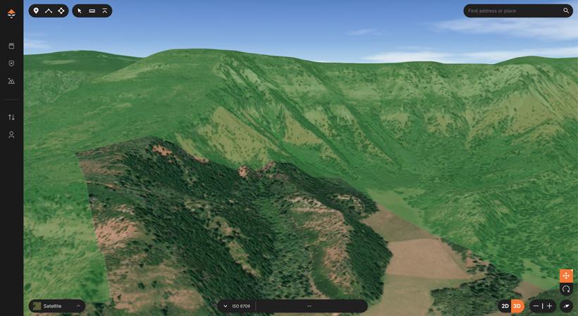
The best way to really dive in is by using GOHUNT’s 3D maps on the web and mobile. This allows me to really hone in on the terrain and see if that terrain I’m looking at might hold animals.
Throughout your research on GOHUNT Maps, you’ll soon know where to park and where to access, and you can sometimes even figure out where pressure is going to be on public land by its proximity to roads. All of these are key pieces of information to plan ahead for your next hunt.
One small tip I use is color coding my waypoints when I’m in the planning and research phase. For example, all waypoints that have to do with access, turns, trails, vehicles, etc. I make white. Then I go in, and I’ll change the waypoint icon so I can quickly see what these waypoints mean. If you have a different strategy, then by all means, use it. I just say that whatever system you use for organizing that you stick to, it so it becomes second nature. My other main color of choice is for places where I’ve seen animals I use the color light blue. To me, this is a very easy color to see, and by doing this, I’m easily able to see what types of terrain features, or in this use case right now, how close to public land/private land borders these animals hang out near. This is why, when hunting, marking everything you see is very important.
Note: I try to mark every turn and access point for how I’ll get into a hunting area. This could be done by truck or ATV, but the key thing to remember here is I will only mark areas that allow me to access public land. It does me no good to mark a turn to an area that is a road that is all private access as that is just clutter on a map that doesn’t help me be more successful.
Next, I find it a great idea to mark several places where you anticipate might be a great glassing spot. I do this ahead of time so I can have backup plans on public land. If a glassing spot doesn’t pan out, I then know I have other glassing spots marked nearby, so I’m not burning up precious hunting time trying to find new spots to glass.
While in the field hunting, I like to take notes of everything on the hunt. Where are people parked? Did I see someone up on a ridge glassing?
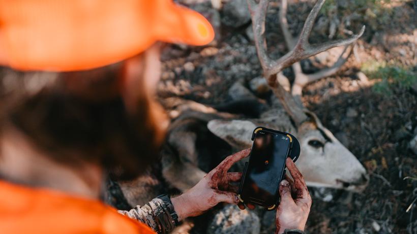
To accomplish that, when I’m in the field, again, I mark everything! All of this will eventually lead to intimate knowledge of the area I’m hunting, which, again, planning and preparation lead to success.
Then, once I’m back home, I can analyze this data on GOHUNT Maps web to see similar areas on public land that I will start to research to try to find more hunting spots and sometimes even better spots. This is again where stacking the Terrain Analysis tool with public land/private land layers can paint a solid picture of the activity you are seeing in your hunting area.
In my experience, when talking to other hunters I meet, friends, etc., it seems that a lot of sections of public land get overlooked. There are lots of smaller parcels of public land that are avoided, and the ones that are near private land tend to scare people away as they might be worried that all the animals are only on the private. But avoiding those areas might be the best course of action. Case in point: the other year, I sent my brother and his friend to a piece of public land I had hunted a bunch, and both of them said the piece looked too small and were worried as there weren't many places to access the larger section of public. I explained to them where to park and how to navigate through the public land, and if they kept going, that small section connected to a larger section of public land that was surrounded by private land without access on the backside. They followed my plan and ended up hunting unpressured mule deer, and they both took awesome bucks a few days apart in this spot!
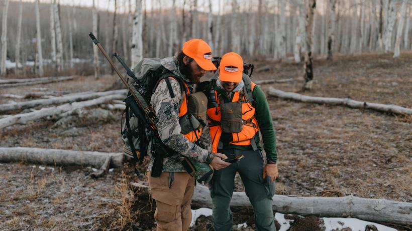
One key point is you need to know where you’re at during the entire hunt if you hunt these spots, especially when you’re hunting public/private land borders.
A little tip I always use when hunting these spots is I’ll turn on my tracks in GOHUNT Maps, that way, I can see exactly where I’m walking and ensure I’m 100% on the right side of public at all times, especially when there is not a clear fenceline. This is also great when you meet someone in the field as you have proof that you only stepped foot on public land. Those tracks are then again useful the following day if you need to wake up extra early and hike in the dark to a gem of a spot on public land. As you now know how long it will take you to hike there if you time it going out and drop that as a note in GOHUNT Maps.
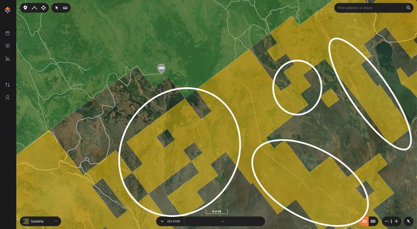
In the above example, I have highlighted several areas that could be considered overlooked. You'll notice I have a spot marked where you can park for some of the areas on the left side of the map. Those areas circled might seem small, but that private land could hold deer.
Accessing public land (government land) layers on our mobile app is super simple. Simply go to the Library, Select the state, and tap on Government Land.
Then, all that research you do e-scouting on the web will allow you to take that information in the field and then navigate some of these small sections of public land that border private land and get access to larger chunks of public land.
While there are many more strategies to success, these are some easy methods to use no matter the hunt. So plan your hunts right now on the web, jump to our mobile app, and take all that research in the field with you.
This article was originally published October 17, 2022.