A simple guide to decoding terrain features and using them to hunt elk and deer more effectively
Satellite imagery is flashy, and GOHUNT Maps makes it a tap away but when it comes to reading terrain, predicting thermals, and navigating backcountry efficiently, it’s hard to beat an old-school topographic map. Contour lines give the landscape a 3D feel, reveal subtle features, and help you make faster, smarter decisions in the field.
Use this guide to level up your topo game and build a hunt plan that doesn’t just look good in 3D it works in real terrain.
Use this to estimate travel time or plan safer routes in the dark.
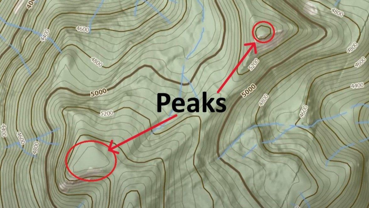
Contour rings that form tight circles mark peaks and knobs. Dropping pins on these high points builds a hit list of glassing zones much faster than panning around in 3D mode. Mark them easily and check them out to find the best views in the unit.
Knowing both lets you hunt the spine or the belly based on thermals and pressure.
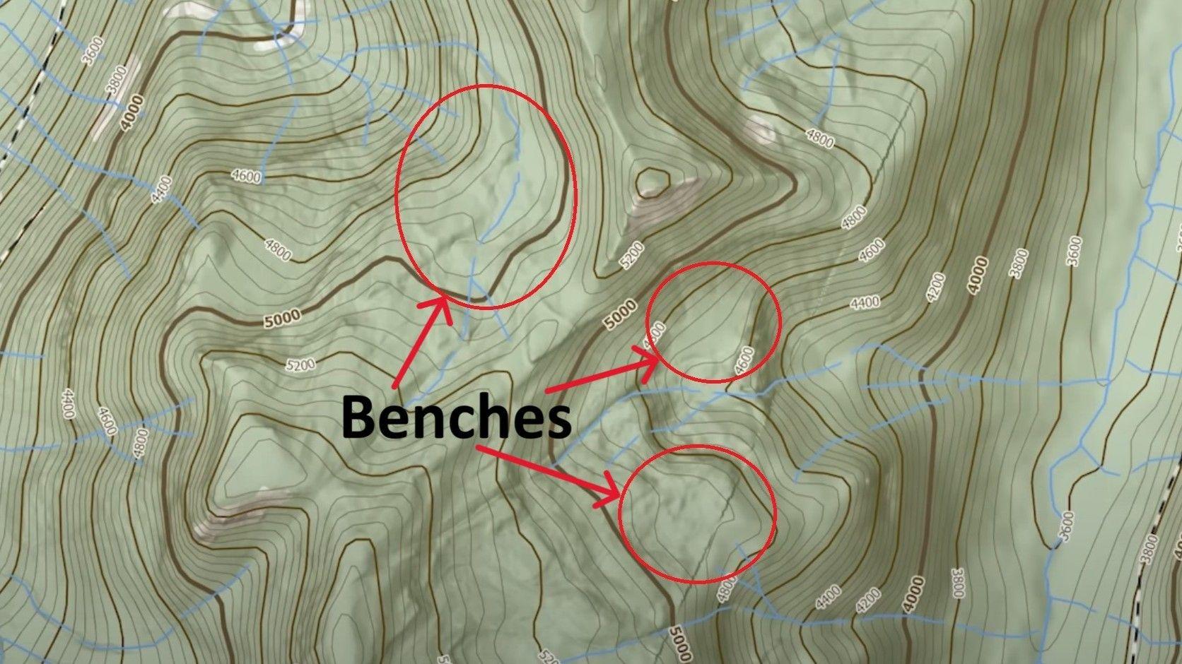
Where tight contour lines suddenly space out along a slope, you’ve found a bench. Shaded, level benches, especially on north or east-facing timber are prime spots for midday elk beds. They’re often hidden in aerial views but pop out clearly on a topo map.
Mark every one. These are money.
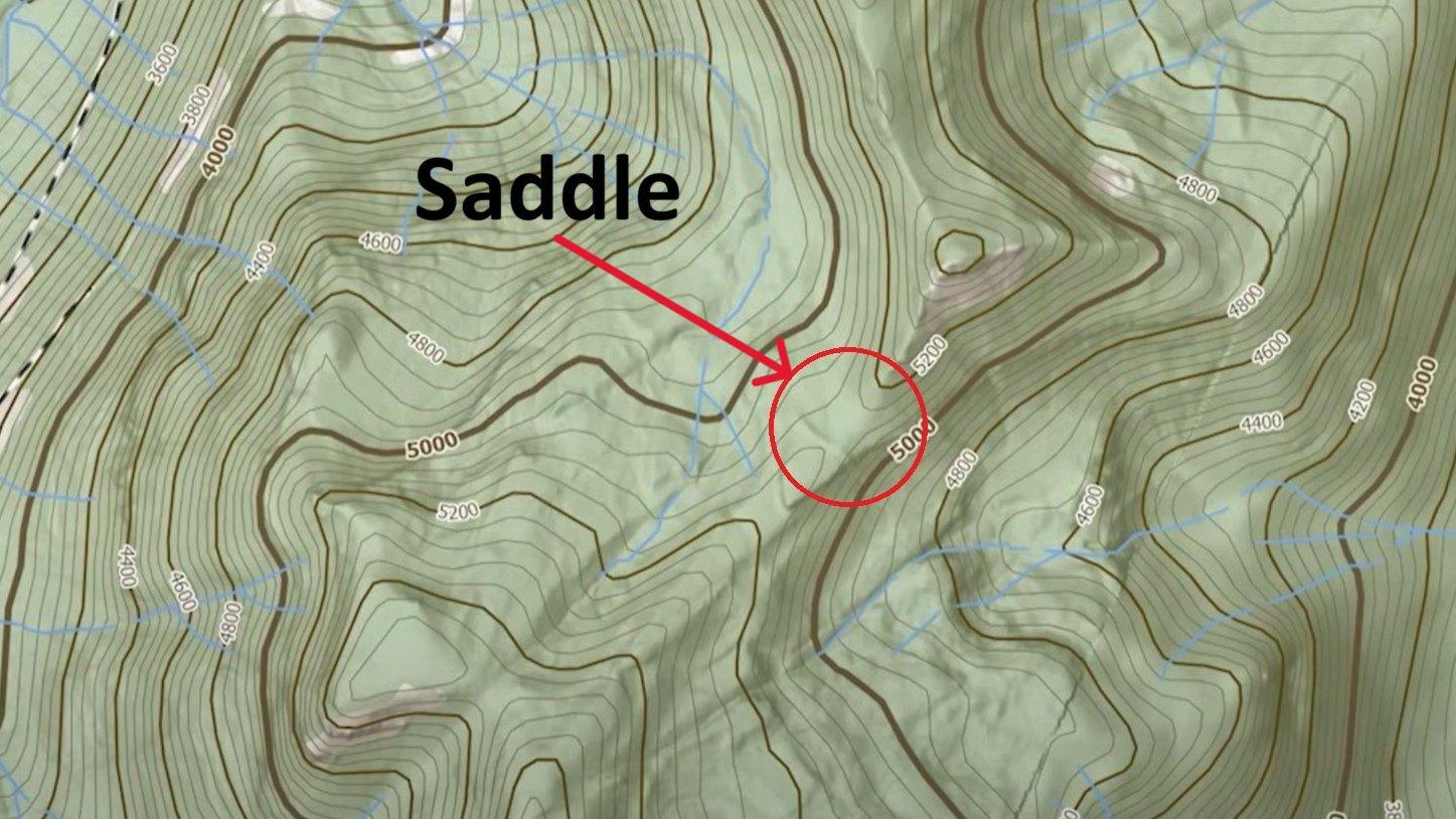
Saddles are narrow dips between two high points. Think of them as nature’s crosswalk, especially for mule deer shifting between basins. Glass both sides early, then move in once thermals stabilize.
Join the thousands of DIY hunters using GOHUNT Insider to unlock:
Then stack it with filtering tools and draw odds to find the sleeper units others miss.
Rotate your map north-up and read slope direction to anticipate conditions:
Thermals follow the sun. Topo maps help predict where downslope air rules the morning and where updrafts dominate the afternoon.
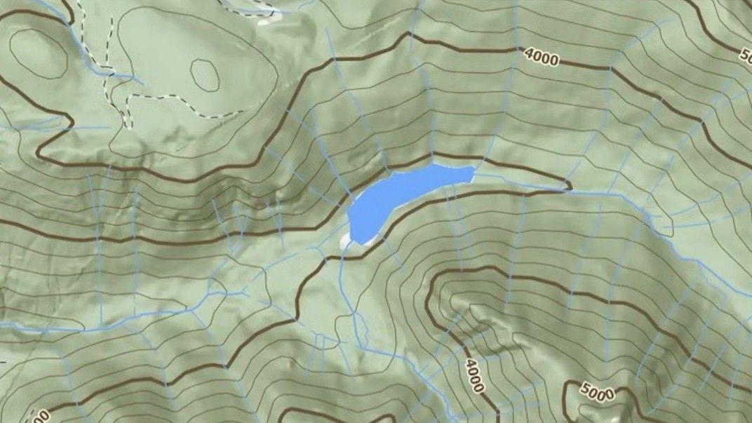
Blue lines and ponds stand out clearly on the tan-green topo layer. Even small seeps, seasonal creeks, or canopy-covered ponds show up when you zoom in. This is especially useful in arid units where aerial imagery hides water sources under heavy trees.
Topo lines help you link gentle contours, ridge spines, and saddles into more efficient travel routes. Pre-plan tracks on your desktop and sync them to GOHUNT Maps. When you’re in the field, topo lines let you double-check whether that shortcut saves time or hides a cliff band.
Satellite imagery is great for seeing vegetation, burn scars, and habitat but topo maps still lead the way for terrain reading, thermal prediction, and locating glassing spots. Add this layer into your e-scouting routine and you’ll enter every hunt with smarter routes, better glassing areas, and a solid Plan B when the wind flips.
Now crack open that topo layer, mark those benches and saddles, and get your fall hunt dialed in.
Got a favorite topo trick we missed? Drop it in the comments. The GOHUNT crew is always down to swap map hacks.
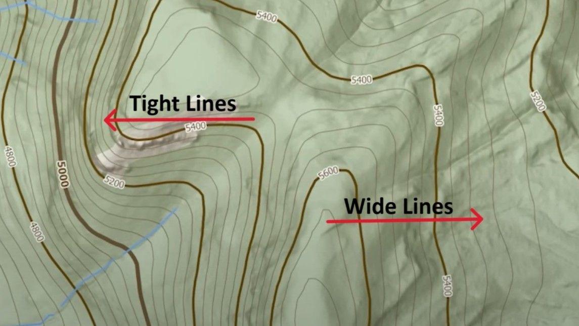
Tight lines = steep terrain. When contour lines are close together, you’re looking at a slope that drops off fast. Expect slower climbs, technical footing, and longer pack-outs. It's also a great way to spot cliffs along your route.
Wide lines = low-angle ground. Spread-out lines mark gradual elevation change, ideal for easier ascents, rolling benches, or bench and saddle terrain worth glassing.
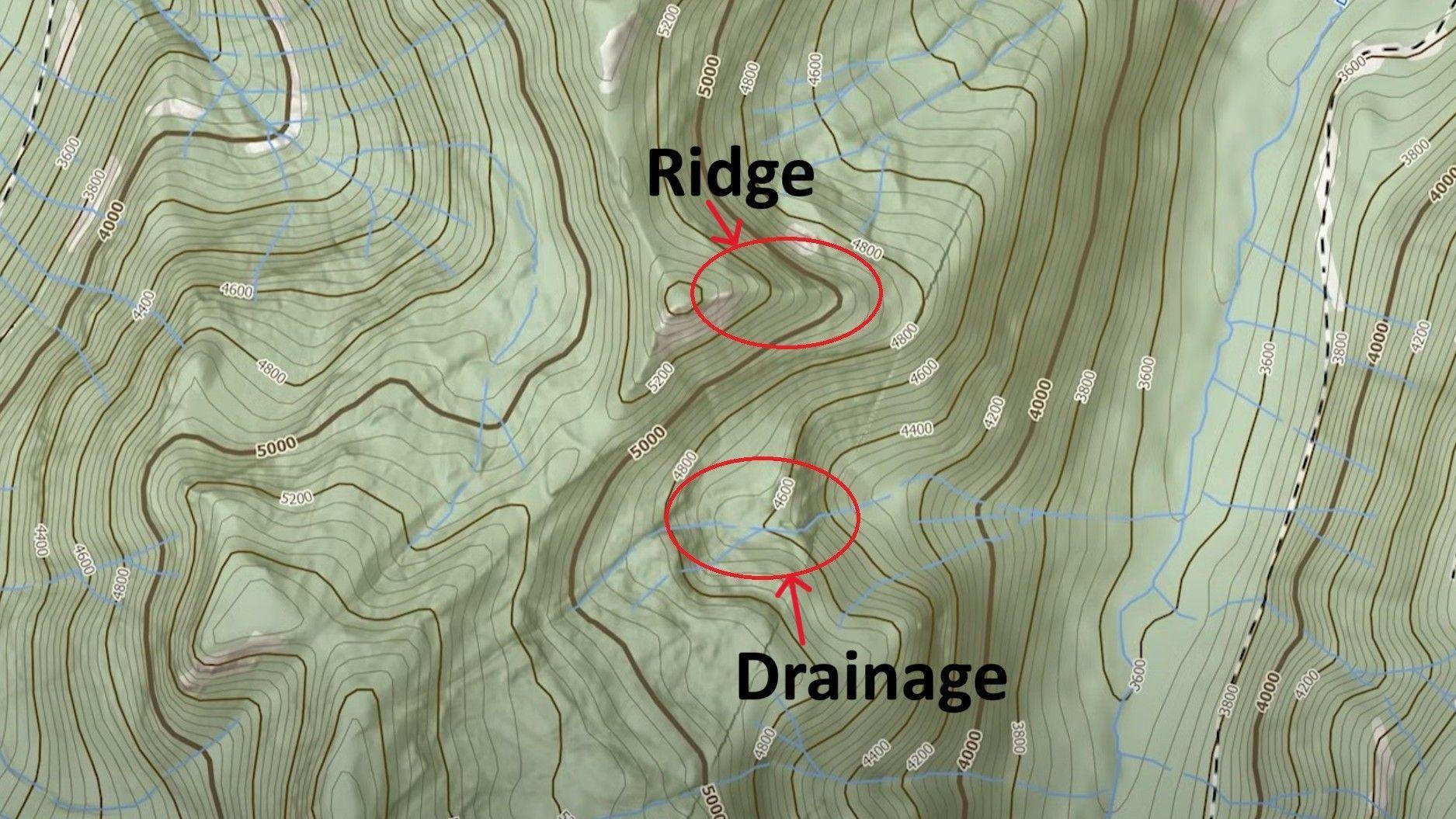
Ridges: Look for elongated “V” or “U” shapes pointing downhill. Elk and deer often bed on ridgelines for cross-thermal air and fast escape routes.
Drainage bottoms: These look similar, but point uphill. They mark the guts of draws that often hold water, shade, and quiet travel corridors.
3D maps + terrain analysis
Public/private boundaries & landowner data
Rangefinder & measurement tools
Hunter-specific waypoints + weather layers
Easy offline downloads for remote hunts
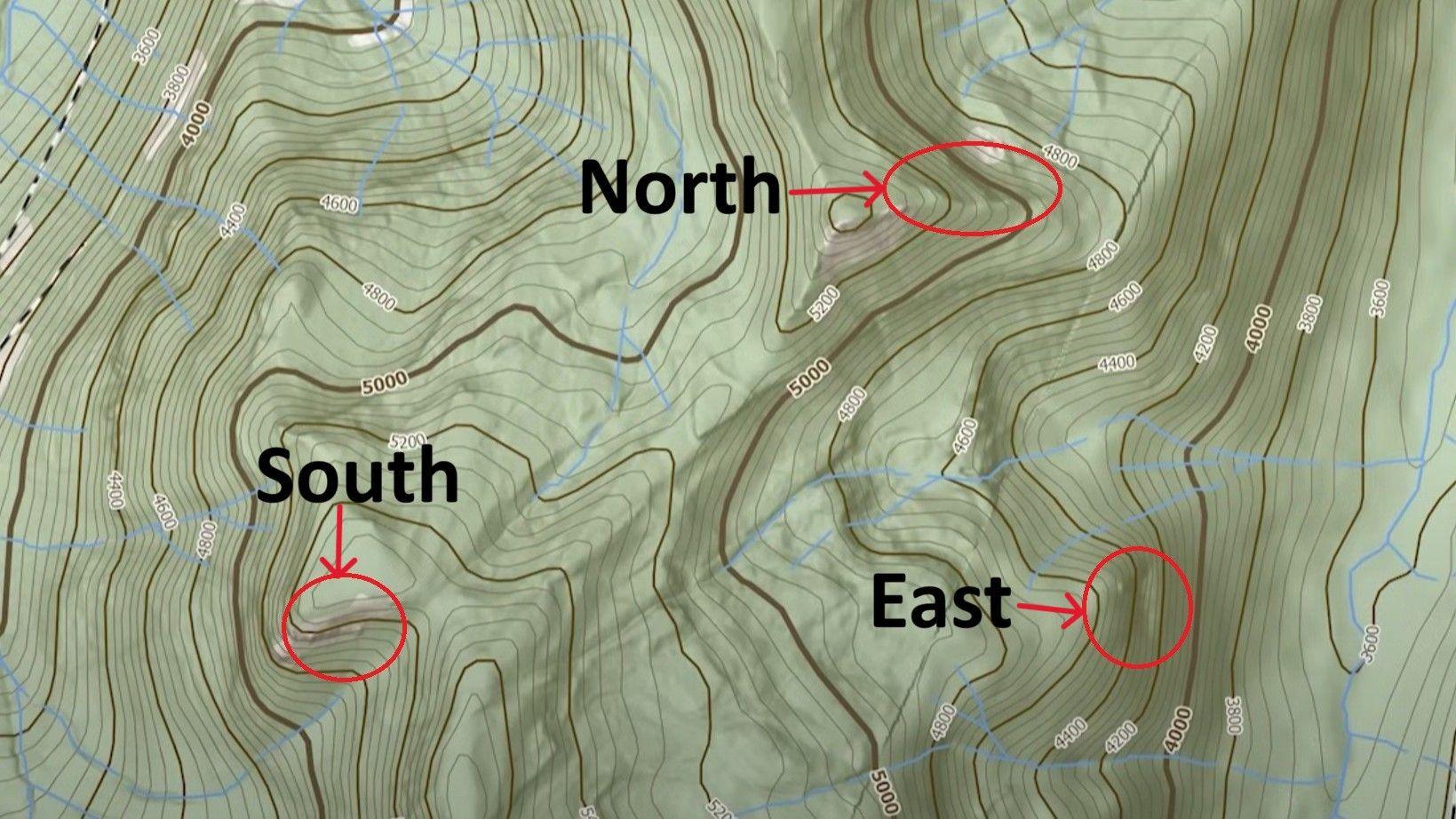
North-facing: Cool, shaded timber is classic early-season bedding
East-facing: Gets first light and early shade, often holds good feeding spots
South-facing: Hot and dry early, but critical after snow hits in rifle season